

THE WORST storm in more than two decades could hit the county early next week with forecasters warning of 80mph winds and flooding.
Worcestershire has been placed under an Amber Warning for wind by the Met Office from just after midnight on Monday (October 28) until 9pm with an intense low pressure system expected to move in from the Atlantic.
Experts have warned it could be the most dangerous storm to cross the country since The Burns Day storm of January 1990 when dozens of people died and billions of pounds worth of damage was caused as winds topped 100mph.
The warning from the Met Office said: “A very intense low pressure system is forecast to run northeastwards across the country early on Monday, bringing the potential for an exceptionally windy spell of weather for southern parts of the UK.
“At the same time, persistent, heavy rain could cause some surface water flooding.
“There is the potential for gusts of 60-80 mph quite widely and locally over 80 mph, especially on exposed coasts, both in southwesterly winds ahead of the low centre and west to northwesterly winds behind it.
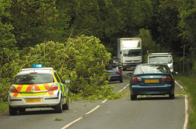
“There is some continuing uncertainty in the timing, intensity and track of the low. However, the public should be prepared for the risk of falling trees as well as damage to buildings and other structures, bringing disruption to transport and power supplies.”
Worcestershire County Council officers will also be monitoring conditions over the weekend and additional highways teams, including gulley emptiers and tree removal contractors, will be on standby ready to work whenever necessary. Key flooding ‘hotspots’ and Ford crossings are also being checked ahead of the potential storm.
A Worcestershire County Council spokesman said: “We’d encourage people to check forecasts over the weekend. If residents are planning to make journeys we’d urge them to ensure their vehicles are prepared, to take care and to always drive according to the weather conditions.
“Highways teams are on standby ready to work whenever they are needed and checks of flooding hotspots are being carried out ahead in anticipation of the storm forecast.”
Exactly where the strongest winds are going to be and the maximum strength of the gusts is not yet known, but there will be regular updates on the Met Office website at www.metoffice.gov.uk throughout the weekend.
The latest information on road closures, bus service disruption and school closures will be available at www.worcestershire.gov.uk