

ANOTHER bout of severe weather is set to slam into the city this weekend with warnings the River Severn could approach levels seen during the devastating floods of 2007.
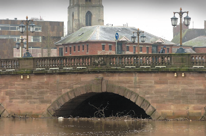
The Environment Agency is warning the Diglis Gauge could peak at five metres on Sunday (February 9), just 30cm lower than its highest ever level recorded on July 21, 2007.
The Worcester Gauge could measure up to 5.4 metres on Sunday, approaching its highest ever of 5.64 metres which was also recorded on that fateful day in July.
The flooding means Hood Street, Quay Street, Pitchcroft Lane, Waterworks Road, Newport Street, Croft Road and Diglis Dock Road are likely to remain under water for the foreseeable future.
New Road cricket ground and Pitchcroft Racecourse will also remain under several feet of floodwater.
The Met Office has issued a yellow warning for heavy rain from another deep low pressure system swinging in from the Atlantic from about 9pm tonight (Friday) before it clears on Sunday.
A chief forecaster at the Met Office said: “An area of low pressure and its associated fronts gave some 15-30 mm of rain across many southern areas during Thursday and Thursday night. This has led to further flooding in places.
“A further Atlantic frontal system will bring a band of rain quickly eastwards during Friday night and early Saturday, with the heaviest rain again likely to be across parts of southern England and south Wales.
“This will be followed in turn by heavy showers and some bands of more persistent rain rotating around the major depression centre as it crosses northern areas. Winds will also be a feature with severe gales possible around coasts in the south and southwest of England and parts of Wales.
Another wet and windy night could be in store on Monday (February 10) with an early yellow warning for rain issued.
“Another area of low pressure and its associated fronts are likely to affect the UK during Monday night and Tuesday, bringing a further spell of heavy rain and strong winds, particularly to southern areas,” the chief Met Office forecaster added.
“There is considerably uncertainty in the track and timing of this low pressure system, but with ongoing flooding in some places, any further rain will only add to the problems.”
Following the warnings, Worcestershire County Council staff have been out clearing drains and gullies and they are also working with the Environment Agency to co-ordinate road closures where they are needed.
People are urged to be aware of possible localised flooding and general disruption and motorists are advised not to drive through floodwaters because of hidden hazards.
West Midlands Ambulance Service (WMAS) is also urging residents to take care and stay away from flood control areas, rivers, streams and other waterways.
WMAS Assistant Chief Ambulance Officer, Craig Cooke, said: “We would also advise motorists to exercise extreme caution and not attempt driving through flooded roads.
“Not heeding the many safety warnings puts lives at risk, including ambulance staff and other emergency service personnel called to provide a service in these most challenging of conditions.”
To keep up-to-date with the latest weather warnings log onto www.metoffice.gov.uk and visit www.environment-agency.gov.uk for the latest flood warnings.